Showing posts with label hiking. Show all posts

Trail Days 2011 | Damascus, VA

 
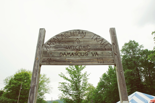
Appalachian Trail Sign in Damascus, VA @ Trail Days

It's been three years since Cody and I started going to the annual Appalachian Trail Days in the small town of Damascus, Virginia. (This year they were celebrating 25 years!) It has become one of those events that automatically gets put on our calendar every year because we have such a great time, and it's only a short one-hour drive from Boone.
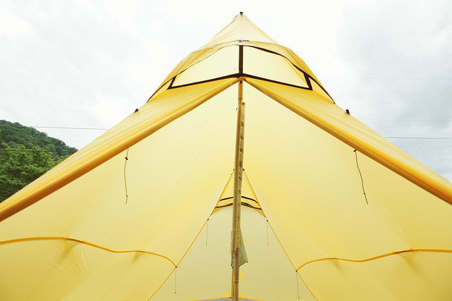
Big Yellow Tent @ Appalachian Trail Days

It's not everyday that you get to bump elbows with hundreds of backpackers who are taking time off the trail to attend this special event. Not all of them are in the middle of a distance hike, however, the majority of them are. You can tell the difference between who is and isn't a long-term hiker by how strongly they smell. That is, unless they've taken advantage of the free showers being offered by the local church.
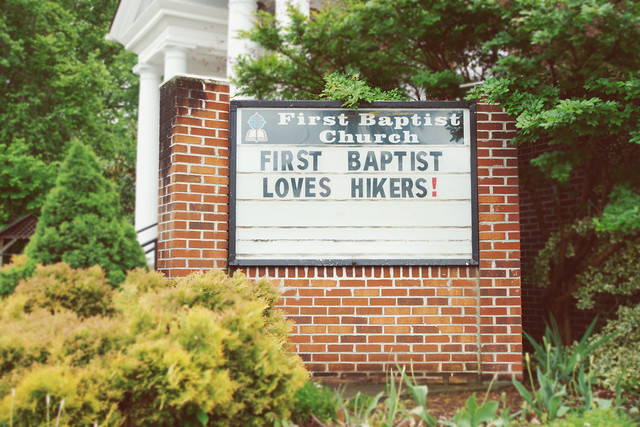
Church Sign @ Appalachian Trail Days

You don't necessarily need to be someone who has hiked the Appalachian Trail in order to attend this exciting event. Heaven knows I haven't hiked the 2,181 mile long trek from Georgia to Maine, and I probably never will. It takes a special kind of person to do something like that. Hiking the AT in it's entirety is no small feat. I'm just not that kind of hiker and/or camper, but I appreciate and respect those who are.
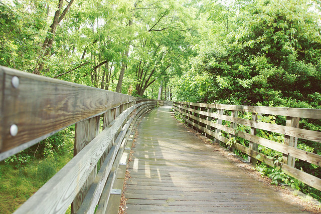
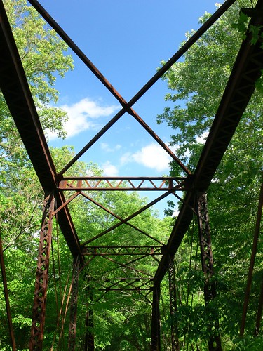
Laurel Creek Bridge in Damascus, VA @ Trail Days

On a normal week, Damascus' population is around a 1,000 residents but that number quickly multiplies during the days leading up to Appalachian Trail Days. Come mid-spring, the town of Damascus becomes a melting pot that blends anyone and everyone who has an appreciation for the outdoors. Although it's mostly those who have an affinity for or a connection to the Appalachian Trail specifically.
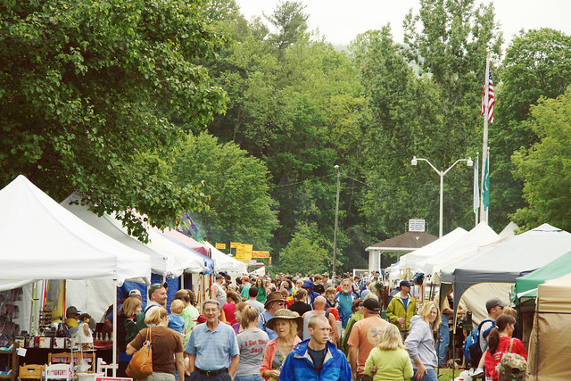
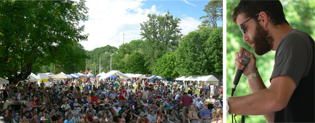
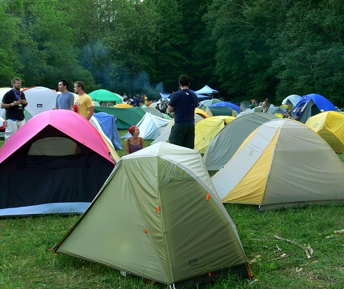
Crowd + Tents @ Appalachian Trail Days

During Trail Days they have outdoor gear vendors showcasing their products, a hiker's parade that may be the largest water fight in the world, an amusing talent show, dozens of tempting food vendors, and lots of other family-friendly fun to keep you entertained!

Colorful Vendor @ Trail Days in Damascus, VA

This year, we missed the hiker's parade because we were too busy schmoozing with the vendors who had neat gear and FREE stickers!

Characters @ Trail Days in Damascus, VA

There are some really awesome products sprouting up that are extremely innovative. Cody and I actually went home with a new lightweight tent (1lb. 11oz.) that we're excited to tell you all about. I'm trying to talk him into doing a guest post!
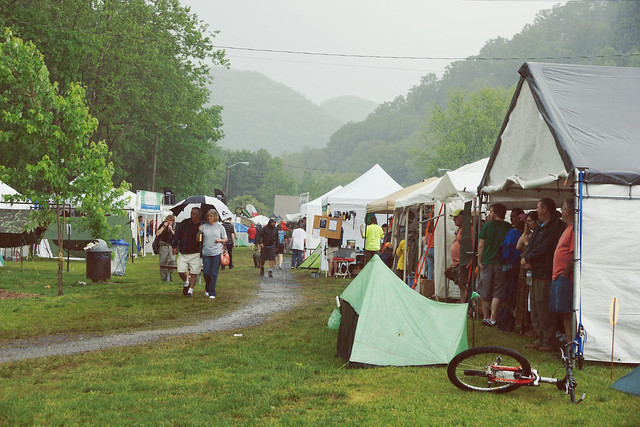
Mid-day Downpour @ Appalachian Trail Days

The weather on Saturday was back and forth all day. It was overcast and cloudy with a slight drizzle that turned into a brief stint of sunshine that developed into a downpour that drenched a lot of people. The ones who needed a bath I hope :D Thankfully, I had an umbrella and Cody had his raincoat, but we still sought shelter under one of the large tents with others who were looking to escape the relentless rain. Even though the weather didn't completely cooperate, we still enjoyed the day we spent in Damascus.
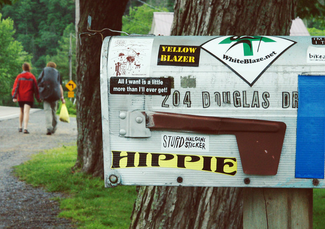
Hippie Mailbox @ Appalachian Trail Days

Appalachian Trail Days is a unique event that brings some really wonderful folks together for a reunion that is, mainly, geared toward backpackers from all over the country who have hiked the AT. However, people from all walks of life can also enjoy this event, especially if you love and enjoy spending time in the great outdoors!


Have you ever heard of the Appalachian Trail? Or have you been to Trail Days before? 
Please share your thoughts in the comments!


You might also like:

Like it? Share it!


    Gallivanting Around Green Knob | Blue Ridge Parkway | Boone, NC

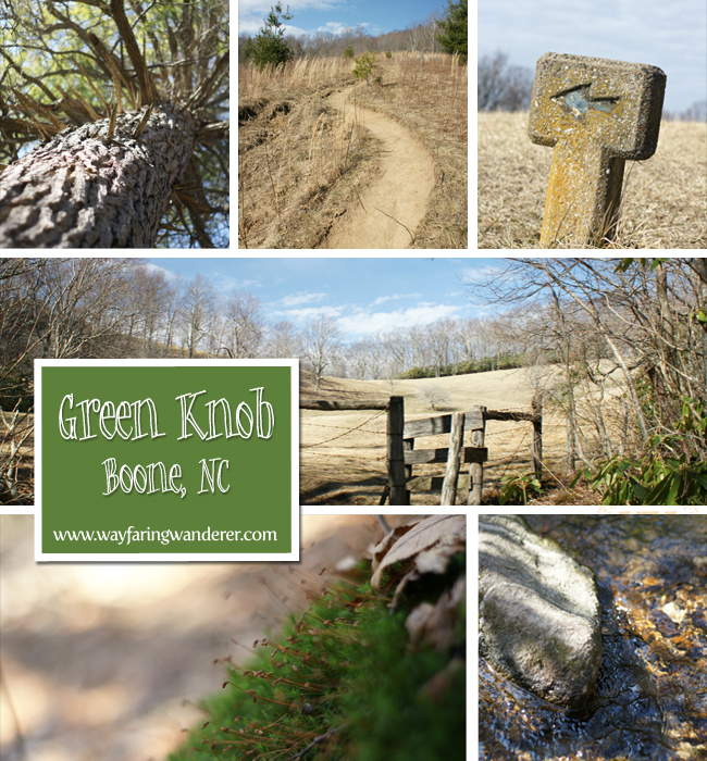
    Green Knob Loop Trail

    With every passing week, I can feel that spring is getting closer. I suppose that making a point to go on a weekly hike is helping me to notice this a little sooner than I normally would. While I love winter and the snowy, cold weather that it brings, it can sometimes cause me to stay stuck in hibernation mode. Lately, though, I've been a whole lot more motivated to get outside and enjoy the warm weather we are awarded instead of being a hermit.

    This week's hike was the Green Knob Loop Trail off the Blue Ridge Parkway (Milepost 295.9) in Julian Memorial Price Park. I've always liked hiking this trail because it's only moderately strenuous, and because it offers a variety of habitats to experience in a short 2.1 mile round trip trek.

    Starting at Sim's Pond, where you can oftentimes find anglers casting away, you'll pass the pond and travel through a rhododendron lined path that takes you into a forest of mixed hardwoods. As you find your way further into the woods, you'll come across some impressively large hemlocks towering over above head.

    During this hike, there are a few creek crossing that require a little rock hopping, but nothing major to contend with. The first half is pretty mild, actually, and is a pleasant way to commune with nature since you can stroll at a snail's pace. For hikes that tend to be more strenuous, I find myself not wanting to stop and take pictures as much as I do when I'm hiking one that's easier. This way, I have more time to focus on the tiny details that can often be overlooked when all I care about is the next level surface to catch my breath.

    Around the half-way point of the Green Knob Trail, the forest will recede and present an open pasture to meander. You'll pass through the fence stile to enter the meadow. This area is oftentimes littered with grazing cows. However, I imagine that it's probably too early in the year for that. As you ascend the gently rolling hills, follow the concrete trail markers to continue along the proper path. This would be a very nice spot to pop-a-squat if you felt like taking a break, though. There's also a bench beneath a tree if you don't want to spread out on the grass for fear of coming in contact with colossal cow patties.

    As you leave the pastoral landscape you'll reenter the woods after a slightly steep ascent. This was the only part of the trail that got me huffing and puffing, although it still wasn't hard to reach the top. From there, it was all downhill. There's one point where you can see Grandfather Mountain & Price Lake, in the distance, as you're descending the trail. And the ridge line of Grandfather Mountain comes into an even better view once you're a little further along.

    After leaving and reentering the forest through a couple more fence stiles—before you know it—you've reached the end! It spits you out on the other side of the Blue Ridge Parkway, which is slightly disorienting. However, your car is just across the street. Compared to the Elk Knob hike I did the week before, the Green Knob trail was easy peasy. The elevation gain for this hike was only 460 feet while Elk Knob was approximately 1,000 feet, and it was only 1.3 miles long, whereas Green Knob was 2.1. Green Knob probably should have been my first hike of the season to break back into it instead of killing myself on Elk Knob!
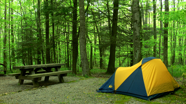
    There are many hiking trails along the Blue Ridge Parkway that are close to Boone. This is one that I hike a few times each year because of how varied (and moderate) it is. And it's even more beautiful during the Spring and Fall because of the pretty wildflowers that appear. According to the things I have read about Green Knob, it's best to hike in April or August during the peak bloom times. I know I'll be going back to see what shows up!

    I highly recommend the Green Knob Loop hike for people of all ages and fitness levels. It would be a great family hike. While this particular Blue Ridge Parkway trail doesn't have the same long range views that many of the others have, it's still a really enjoyable way to spend an afternoon. I'm thinking that when I go back in the Spring we'll bring a picnic to snack on—that is, if the cows aren't around! 


    Related Links:


      My Quest to Conquer Elk Knob | Boone, NC


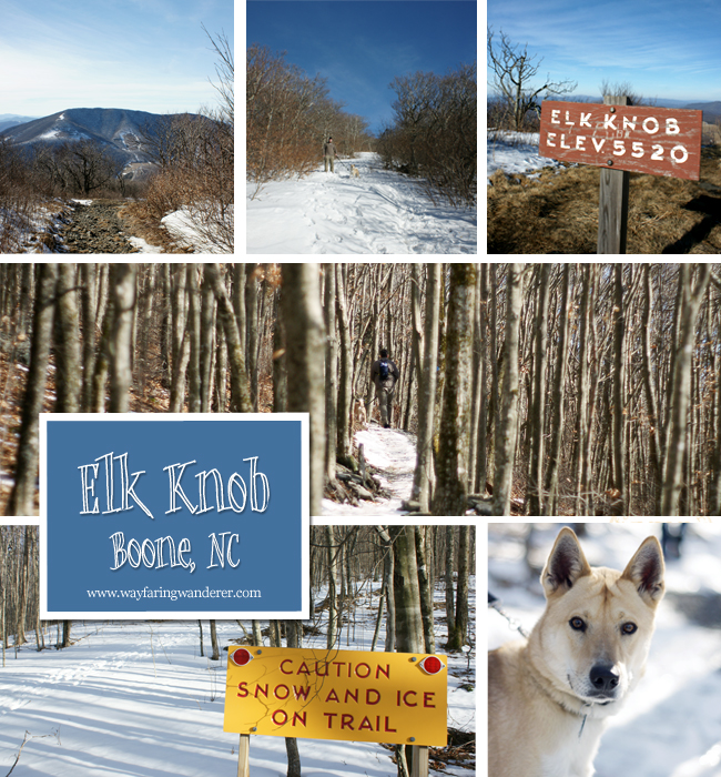
      Elk Knob Collage

      The trail was like a snowy slip-n-slide, making proper balance next to impossible during some parts of the hike. We were utterly surprised upon arriving at the trail head to see that the ground was still blanketed with snow—any snow around our house has long since melted. It escaped our minds that Elk Knob was at a higher elevation, and that it would be a little cooler (and windier) up there, so snow definitely didn't occur to us either.

      While the snow did add another challenging element to this already grueling hike, we steadily stayed the course at a pretty fast pace. Granted, I was a lot further behind the group I was hiking with because I kept stopping to take pictures, but I still kept up pretty well (most of the time).

      This seemingly short 1.8 mile hike made me feel like I was really out-of-shape. I mean, it has been quite a while since I've done a hike and for Elk Knob to be the first one I take on this year probably wasn't the smartest thing to do. I know that I'm making this trail sound really bad, it's not horrible, but I did feel like I was dying at a certain point. (Maybe just a tad bit dramatic.)

      At least I conquered it this time, though! Cody and I attempted to hike this trail back when it first became a new addition to the NC State Park system in 2009. We got very close to the summit, but I started feeling sick and couldn't push myself to finish. This time, though, I was determined to make the climb to the top, but I needed some (a lot ) coaxing. The newly built trail that volunteers have helped to construct has made the Elk Knob Summit Trail a much more enjoyable hike. Now, it has switchbacks instead of making you trek straight up a super steep rocky road.

      To reach the 5,520 foot peak (the second highest in Watauga County) you really have to push yourself to surmount the last 200 feet. It's the only remaining portion of the trail that takes you straight up the old road, and it's a doozie! I'm pretty sure it was the part I couldn't overcome the last time I tried to hike Elk Knob. My first failed attempt made reaching the summit much sweeter this time around. For so long I avoided this hiking trail because I wasn't able to complete it the first time. Cody thought he'd never get me to go back! Having finished it this time around, I don't think it'll be that difficult to get me to go back, especially since it's the closest hiking trail in Boone (aside from what's along the Blue Ridge Parkway).
      Spending the day trudging through Elk Knob's hardwood forest and taking the time to reconnect with the splendor of nature was exactly what this hibernating homebody needed. And pushing myself to finally triumph over this trail was an added bonus! Now, it's getting me to think about all the places I want to venture to as spring approaches. Thoughts of camping, road trips, and more hikes on the horizon are getting me very excited about planning outings for the new season. I'm ready to spend more time outdoors! How about you?

      What are you getting excited about as spring approaches? 

      Fun Things to Do in Fall (Boone, NC & Western NC) - Part 2


       {National & State Parks}

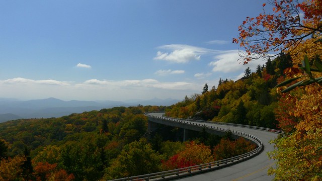
      Linn Cove Viaduct

      6. Blue Ridge Parkway This 469 mile long scenic drive starts in Virginia, meanders through North Carolina and ends in Tennessee. It is an extremely popular destination among those who covet the myriad of colors our region is famous for producing. Seeing your favorite vistas and hikes cloaked in the most vibrant fall colors is an added bonus, however, the congestion the parkway experiences is almost enough to make you steer clear. The BRP is also celebrating their 75th anniversary this year and has events scheduled throughout the season for everyone to enjoy.

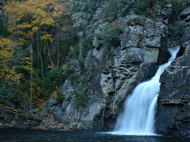
      Linville Falls

      7. Linville Falls Located at milepost 316.5 this highlight is a stop off along the Blue Ridge Parkway that attracts a high volume of visitors during any season. The 90 foot powerful plunge can be seen from many different angles and can be reached through a variety of hikes that range from easy to difficult. It's one of my favorite waterfalls, especially in Fall.

      8. Wiseman's View Just a short distance from Linville Falls this overlook offers an equally impressive display (sans waterfall) of the Linville Gorge. The trail to the rock outcropping requires nothing more than an easy stroll, and the concrete path makes it handicap accessible. This detour won't take much time, which makes it a great quickstop before or after seeing Linville Falls.

      From the Top

      9. Grandfather Mountain At an elevation of 5,946 ft above sea level, the views from this biosphere are incredible, especially from the top where the Mile High Swinging Bridge resides. Wildlife habitats and hiking trails will also keep you busy during your visit to GM to get your monies worth. Not too long ago, the state of North Carolina purchased GM's backcountry for a state park; before this took place an overnight hiker had to purchase a permit to camp, however, now the permits are free.

      Under the Parkway

      10. Hiking @ Cone Manor From this central location off the Blue Ridge Parkway you can access an array of trails. Shuffle through "The Maze" down at Bass Lake or hustle your way up the Flat Top Trail to the firetower where your efforts are rewarded with spectacular 360 degree views. We start a lot of our hikes from this point because it's conveniently located near Boone and we have options to choose from depending on how hard we're willing to work.

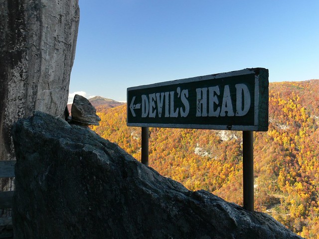
      Devils Head

      11. Chimney Rock State Park in NC A perfect place to find fall and reconnect with nature is at Chimney Rock. With nature trails, a waterfall and fresh mountain air this place seriously can't be beat. It is definitely not a secret, so don't expect to have the place to yourself, though.

      These posts are keeping me motivated about Fall, because right now it seems as though we skipped this season altogether and winter has begun to set in. Or at least it has for the past two days. We've already had our heater on and I've broken out the sweaters! I hope this cold snap subsides soon, because I really want to experience some FALL.

      This is a continuation of a series about "Fun Things to do in Fall". In part 1 (link below), I shared a list of festivals and fairs happening across North Carolina, and even one in Georgia, while this portion of the list is focused more on state parks around Western North Carolina. With this list you will find links to archived posts or to other websites where you can gather more information.  

      Related Links:

        Honolulu's Most Popular Hikes


        It's hard to go to Hawaii and not commune with nature. However, there are some really great things you can do to immerse yourself even farther instead of sticking to the white, sandy beaches. My favorite way to do this is by taking a hike! The island of Oahu is riddled with trails if you know where to look, but there are two trails in particular that get all of the praise. So popular, in fact, that these outdoor adventures can see hundreds of tourists everyday! The two favored hikes in Honolulu are very different from one another in the realm of landscape and atmosphere. Now, two hikes in one day may sound like a bit too much, but I chose to do so because they were very close to one another. And since I was staying on the other end of the island, I figured I should hit them both up on the same day.

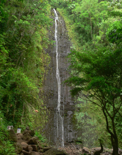
        Manoa Falls

        My first stop was the Manoa Falls trail located just outside of Honolulu in Manoa Valley. I am a sucker for waterfalls, so I had to get a glimpse of this 160-foot tall mammoth. Since this unbelievably lush rainforest was deserted at this hour of the morning (7:30am), I decided that I would forgo taking pictures until I reached the end only because I thought that it would stay that way.

        Banyan Tree

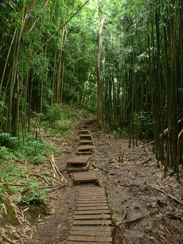
        I walked amidst the gigantic Banyan trees flanked by the everpresent stream. As I made my way up the narrow pathway, portions of the trail were framed by bamboo forests. I found this trail to have a very gentle grade, and at only 1 mile each way, it's one almost anyone could undertake. One thing to be careful of on this particular trail is the mud, because it can be slippery! It receives quite a bit of rain from what I have read, although maybe it hadn't rained much lately, because the cascade was meager. It wasn't too terribly disappointing though, since it took little effort to get there.

        Bamboo Lined Path

        Remember how I told you that I saved taking pictures until after I reached the falls? Yeah, well, that was a HUGE mistake! On my way down I passed numerous guided tour groups that made it nearly impossible to get a shot without someone being in the way. That is the last time I wait to take photos again!! Seriously. Who needs a tour guide to take a hike? I don't. Nature is free :D

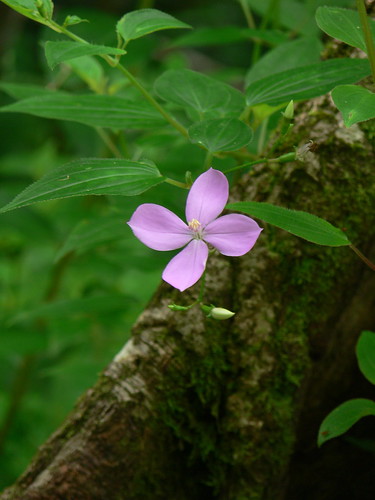
        Purple Flower

        Parking, however, is not! I didn't find this out until I got back to the Jeep where a little yellow note asking me to see the attendant regarding payment was stuck to my window. Be forewarned that they charge $5 to park in the parking lot at the trail head. I got away with only paying $2 because I claimed stupidity. Sucka! Seriously, though. I didn't see any signs that said there was a charge, and I certainly didn't overlook an attendant!

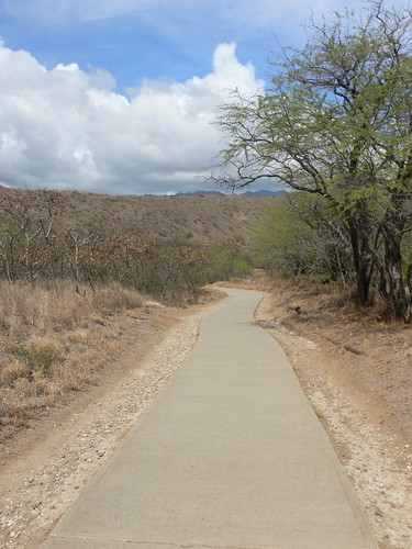
        Concrete Start

        The next stop, Diamond Head Crater, is considered the most popular trail. It likely sees twice the amount of hikers that Manoa Falls does. Unlike the gentle grade of the last trail, this one is much more vigorous. Even though you start off on a concrete path that seems forgiving, it quickly morphs into switchback city!

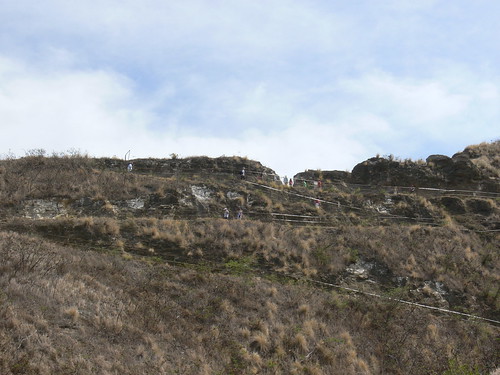
        Switchback City!

        From the crater floor to the summit you will climb 560 feet in less than a mile (0.8 to be exact). By the time you weave your way through the switchbacks, you are begging for mercy as the sun is blazing and the sweat starts pouring. It would do you good to be very well hydrated before attempting this trail unless you are a fan of fainting.

        99 Steps?!?!?!

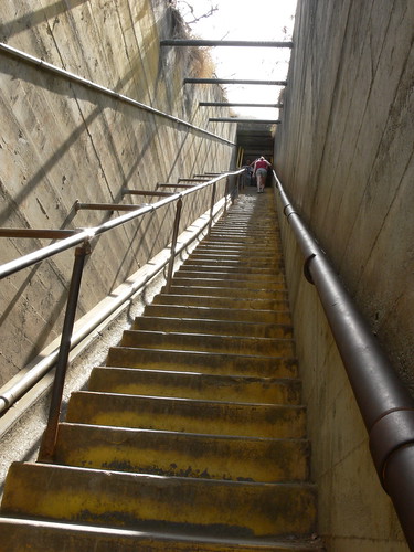
        You begin to think that the worst is over, but that's when you are met with a steep concrete stairway consisting of 74 steps! Afterward, you get a chance to cool off in the tunnels that take you below the surface. The closer you feel to the top, though, the further away from reality you are because after stepping out of that dark tunnel, you are standing at the foot of yet another staircase! Some just stood there, mouth agape, staring in disbelief at the towering approach. More steps!?!? Yes, 99 of those bad boys :D And just when you think you can't take another footstep, they make you climb a spiral staircase!!

        Crater Surroundings

        At this point I felt somewhat tortured, but the end was getting near. I could feel it. Okay, well, not as close as I hoped....More stairs?!?! So, let me get this straight, we've scaled a windy path of switchbacks, a 74 step set of stairs, burrowed through a tunnel, climbed another staircase with 99 grueling steps, spiral staircase with 52 stairs and last but not least a 3rd set of stairs with 54 more steps! Holy mama!! Lemme catch my breath......

        Mini Waikiki

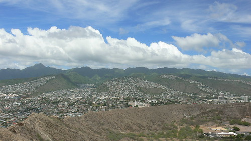
        I suppose that this trail wouldn't be so popular if the views weren't worth every drop of sweat shed along the way. The vista was most definitely a stunning sight with the Pacific ocean and Wakiki coastline in full view. As a matter of fact, this is an ideal spot to see a panoramic view of the Leeward side of the island.

        Me on top of Diamond Head

        One good thing about hikes that make you work so hard going up, you know it's all downhill from the top! Despite how horrible I may make this hike sound, I saw so many different types of people trudging to the summit. I even passed a lady who was wearing high heels! No lie. And she did make it to the top...eventually :D

        Related Links:

        The Difference Between Delicious & Dangerous!!

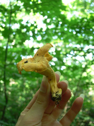
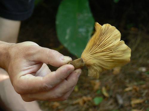
        Chanterelle Mushroom

        There is a fine line between delicious and dangerous when trying to determine whether or not a wild mushroom found on the forest floor is safe for the dinner table, or poisonous to consume. The latter being what you want to avoid at all costs because digesting unsafe fungi can cause serious illness, and in some cases, even death!

        [WARNING: Never attempt to eat a mushroom unless you are able to positively identify the specimen in question!!]

        Warnings, like the one above, can scare you from even considering such a thing as hunting mushrooms for fear of the unthinkable, but this is why it is wise to exercise extreme caution.

        Don't Give Up Yet...

        There are a few varieties of edible mushrooms that can be recognized by simple characteristics, such as shape, size, and color. A few of which we learned about while bushwhacking through the ASU Woods a few weekends ago. Our main objective during this PACT hosted Edible Mushroom Tour with Dr. John Walker, an ASU Biologist, who specializes in Mycology (The study of fungi), was to seek out the shrooms and learn identification techniques with the help of a professional guide.

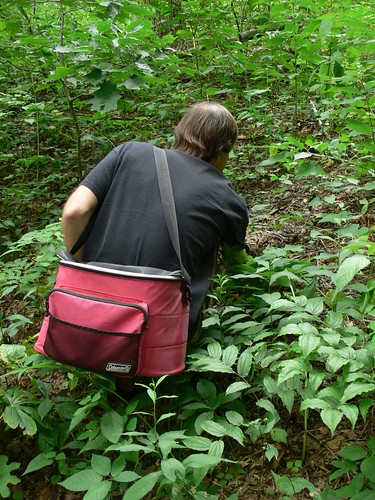
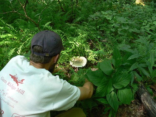
        Mushroom Picking

        I expected that during the duration of these explanations I would hear a ton of words that I hadn't ever heard before--and I did. It was almost like listening to someone speak a foreign language! One quick and basic rule of thumb that I thoroughly understood, though, was to completely avoid all fungi that had gills.

        Mushroom Gills

        While there may be some that are safe to consume, it is still extremely difficult to identify them. Even a highly trained instructor is hesitant to eat from that category. Not something you want to take a chance with.

        Endless Possibilities....

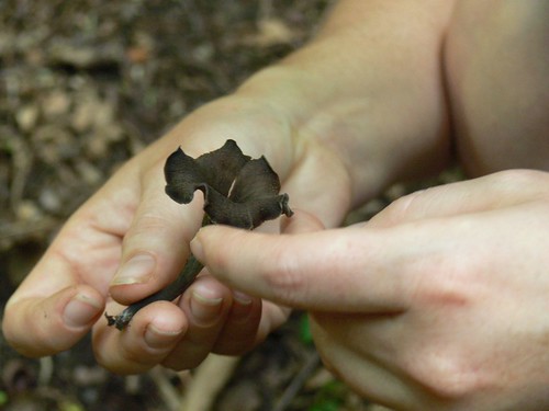
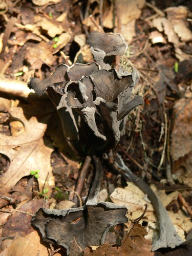
        During our trudge through the forest, we encountered many different varieties of mushrooms. While they are all pretty too look at, I now know what to steer clear of, as well as a few tasty treats we could take home should we get lucky enough to come across them again. We did, however, have the very good fortune of accidentally stumbling upon a patch of Black Trumpets when trying to find our way back to the trail.

        Black Trumpet

        Black Trumpets

        After a few hours of foraging, we were invited to go back to Dr. Walker's class room where he had a makeshift cooking station handy so that we could taste test what we found out in the field. We devoured the tender, crispy bits while at the same time trying to savor the flavor of the fleshy fungi. This was the part where a smaller group was favorable since that meant more to go around :)

        Gain Knowledge & Build Confidence....

        I actually feel a lot more confident about deeming certain delectables safe since attending this foray. I don't want to get into the technical verification 'tests' involved here on WW because I don't feel qualified to provide you with the proper information, but if you're interested in learning more, the info is plentiful. Whether you find a local specialist who might enjoy giving a tour in your hometown, or you dig into a comprehensive guide book to sharpen your skills, be sure that you do your homework before "testing the waters."

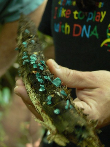
        Weird Blue Mushies

        You can start by doing some research on what you could expect to find based on your geographical location. Look for, not only those that are edible, but others to avoid, as well as possibly poisonous lookalikes. One thing we didn't touch base on too much were spore prints, which is supposed to be another great way for the less experienced to identify edible wild mushrooms.

        Deadly Discovery!

        Yes, there are risks involved, but you just have to be aware and well informed to remain on the safe side. Even if you only head out with the intention of admiring and/or photographing them, think about going on your own mushroom hunting expedition once armed with new knowledge. I promise that you will make all sorts of interesting discoveries when you are closely paying attention to those often overlooked details!

        Hope you have a wonderful weekend :o)

        The 3 Easiest Waterfall Hikes in Shenandoah National Park (Part 2)

        3. DOYLES RIVER FALLS

        Doyles River Falls - Upper
        (Upper Falls)

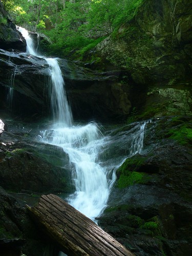
        For our last day in Shenandoah National Park we picked this trail because there were not one, but two waterfalls! The round trip hike of 3.2 miles is moderate on the way down, but the return climb is STEEP! So steep it seems that you are pretty much at a half-jog the whole way down. Almost too quickly we reached the Upper Falls, from there we decided to bypass it because of the crowd and kept going until we got to the Lower Falls.

        After taking our time on the sharp switchbacks, the 63 feet of water furiously spilling down the rockface came into our view. I charged toward the small landing beneath the falls, but was stopped dead in my tracks by what I though to be a live snake! I screamed!! Cody, my knight in shining armor, quickly came to my aid. Upon closer examination we realized it was not moving and was a little bloody--someone killed it. Strategically, we removed it from the path so no one would have a heart attack from having the daylights scared out of them, like I almost did.

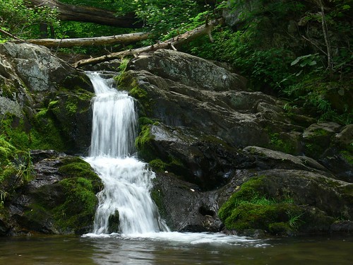
        Doyle River Falls - Small Cascade
        (Small Cascade)

        A little more cautiously this time I made my way down and set up my tripod to get a picture. I didn't have too much luck here because the sun was shining directly on the top of the falls (overexposure), so I thought best to move on. On the way back out we stopped to see the Upper Falls, it was still crowded. The grotto-like setting was nearly impossible to capture without a moving subjects hopping into the scene. Somehow, I got lucky and was able to fire off a few shots.

        Doyles River Falls - Lower
        (Lower Falls)

        Midway, I remember thinking to myself, "This isn't too bad!?" I even protested saying so out loud just in case I would be jinxing myself by doing so. Of course, I did! That's where things started going "downhill".....It was BAD, real BAD! I almost wanted to warn everyone we passed to turn back, especially when we came to a lady resting on a bench on the way down! She had no idea. Without saying a word, we trudged along. There were moments that I wanted to die or either pass out (just a tad dramatic), but without incident, we made it back to the trailhead.


        In case you missed it:
        The 3 Easiest Waterfall Hikes in Shenandoah National Park
        (Part 1)


        Like it? Share it!

        The 3 Easiest Waterfall Hikes in Shenandoah National Park

        There is nothing that I like more than to see the awe-inspiring beauty of a flowing cascade. What can some times make that desire difficult to achieve is the time and effort it can take to get there. Since there are no waterfalls that are visible from Skyline Drive in Shenandoah National Park, to see one you must be prepared to take a hike. Cody and I were looking to maximize our time, and at the same time minimize exhaustion, so we set our sights on some of the shorter and less difficult treks. Of the nine waterfalls in SNP, though none are easy, there are a few you might find more manageable, but every bit as beautiful.

        1. DARK HOLLOW FALLS

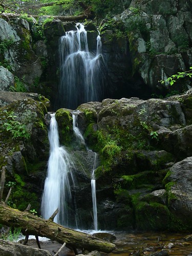
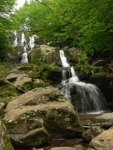
        Dark Hollow Falls

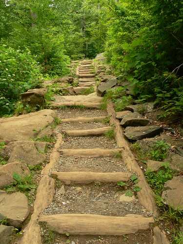
        This particular waterfall appeals to a wide audience because it is easier to get to, which means that it can be pretty popular. Even so, we thought the 1.4 mile round trip would be a great excursion to start off with. The trail hugs Hog Camp Branch as you make your way down the tree-lined path, which can become steep at times.

        Log Steps

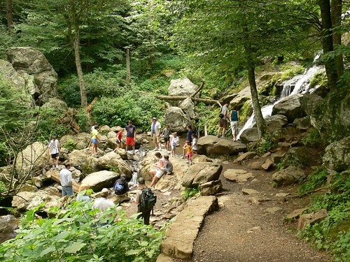
        Once you reach the bottom a series of rushing cascades create an impressive 70 foot display (as you see above). I was lucky to have located a spot to shoot early on beacause it wasn't very long before a rather large group joined us down below, and by join us, I mean, blocked my view! :D

        Crowd @ the Falls

        The clouds were being even less cooperative, so somewhat frustrated, we made our way back across the river to begin our ascent. I remember taking a break or two on our way back up, but all in all, it wasn't so bad.

        2. LEWIS FALLS


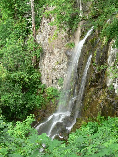
        Lewis Falls

        After a short nap at the campsite we awakened with vigor and were ready to tackle another trail. This one was really close to the Big Meadows campground, our homebase. Another bonus was that this was a short stroll at 2 miles. The footpath to Lewis Falls was strewn with rocks and can be tricky, so sure footing was a must! Once the sound of rushing water becomes louder a panoramic view of Pine Grove Hollow opens up before you. The end brings you to a rock-walled observation area where you can view the 81 foot falls from afar. I felt a little jipped because that wasn't what I expected, but it was still lovely. Other than having to navigate the rocky terrain, the return hike was fairly mild. We did, however, almost cross paths with a skunk, but thankfully he was in his own little world!

        3. DOYLES RIVER FALLS:

        Click here for Part 2!


        Like it? Share it!

        Appalachian Trail Days in Damascus, VA

        Once a year the town of Damascus, VA. becomes a mecca for those who have an affinity for the Appalachian Trail. For the few whom have never heard of the AT, it is a trail that runs from Georgia, all the way to Maine. Damascus is roughly the halfway point of the 2,175 mile journey. The town is especially popular amongst hikers because it is the only part of the AT that actually passes thru a town. Since the sidewalk is part of the trail, on any given day, you can find a few weary backpackers walking along the roadside loaded down with gear. On these days, however, you are more than likely to find hundreds of them!

        Bridge

        Open to any and all who may have thru-hiked, section-hiked, helped to maintain, preserve or anyone who just enjoys being outdoors is welcome to the annual Appalachian Trail Days extravaganza! The point is, whether you have hiked it or not--which I haven't--this special event gives everyone a chance to celebrate the Appalachian Trail as well as its people.

        Crowd Pleaser

        I found this snippet of the talent contest that showcases a really awesome beat box named, Abraham. He was very popular among the crowd, and for very good reason. I bet he wins every year!


        Along with the talent show, they had all sorts of activities including a HUGE water-fight parade (that we missed), as well as various food (my favorite!) and merchandise vendors.

        Colorful Diptych

        We ate an enormous turkey leg, a gigantic ice cream sunday, and
        fried green tomatoes! I couldn't resist the FGT.

        Fried Green Tomatos

        After a clear and beautiful day at the festival we retreated to our campsite tucked deep within Mount Rogers.

        Campsite Mt Rogers

        During the festivities they did offer a special camping area within town. Just imagine, tents and people as far as the eye can see...NOPE...not for me! I like my privacy :)

        See?!?! It is named "Tent City" for a very good reason.
        Tent City

        That night, we got to our tent in the nick of time. As soon as we zipped up the 'door' it proceeded to rain, and did so ALL NIGHT LONG! It was still raining in the morning when we packed up. Thank goodness Cody reminded me to bring my rain coat!

        I'm curious, who here has heard of the Appalachian Trail?

        Here is a link to the 2011 Trail Days 25th Celebration: [LINK]

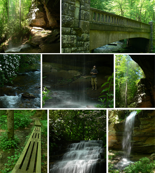
        Stumbling Upon Moore Cove Falls

        Moore Cove Falls

        By accident we found ourselves at the trailhead to Moore Cove Falls. Initially, our intention was to stop and take a few photos from the auto bridge, but we were pleasantly surprised to find this treasure. Because it was a relatively short hike we said, "What the hay, let's check it out!"

        I liked not knowing exactly what we were in for, it made the stroll that much more enjoyable. We followed Moore Creek upstream for .7 miles and crossed a few footbridges (my favorite) along the way. Imagine our surprise when, at the end, we were greeted by a lovely cascade that descended from the top of a cave! It's not very often that you can walk behind a waterfall for an ultimate up-close view. That was a special and unexpected treat, indeed.

        As with the waterfall we visited earlier, I had a hard time capturing a properly exposed photo. A streak of light was brightly shining horizontally across the cascade! Even so, it was an awesome place to have stumbled upon, especially since we were able to witness such a unique view.

        Don't you just love those sorts of unexpected stops?
        What did you find on your last venture?

        An Exploratory Hike to Gentry Creek Falls

        Cherokee Nat'l Forest: Mountain City, TN: Gentry Creek Falls: 5 miles

        This past Saturday we took part in a guided hike lead by PACT. Unfortunately, we didn’t attract the turnout we were looking for, but the few people who did join in made our walk through the woods very enjoyable. It was a special treat since Cody and I don’t hike with other people very often.


        Throughout the trek we all took turns pointing out various plant and animal wildlife, and because I have such a curious mind, this was a big highlight for me. Our hike was more about exploring and less about keeping up a steady pace. Even so, we moved faster than if Cody and I had gone solo. It’s no surprise that I generally stop every few feet to take a photo! Okay, not every few feet......[Cody, stop shaking your head]….okay, every few feet!


        As unconcerned as we may have been about reaching our destination, we finally arrived to the proverbial pot of gold. At the “end of our rainbow” lay a double-decker waterfall, both 30 to 40 feet high. It was magnificent! After a couple photos, we trudged to the top tier where we all sat down to have lunch and tune in to the rushing water flowing past us. Very refreshing, indeed!

        (The photo below doesn't show the one up top)
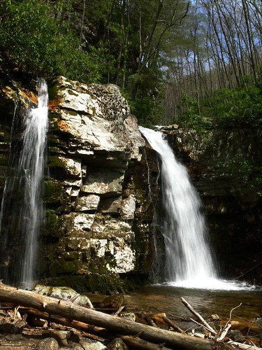
        Gentry Creek Falls

        Well worth the 2.5 miles it took to get to Gentry Creek Falls. Altogether, I would say that it was a very moderate hike with barely any gain in elevation. It did, however, take a little over 4 hours to complete, and the numerous creek crossings did present quite a few obstacles since we had to do it 13 times! After a while, you succumbed to soggy shoes!

        These foot bridges probably have you thinking, "What creek crossings?",
        believe me, we got our feet wet! I just didn't get any photos of it :)


        I do hope to return in the future on an overcast/foggy day to get some better photos of the falls. Not that I am complaining about the gorgeous weather we were graced with, but it’s just not conducive to taking good waterfall photos. Note to self: Remember this the next time you don’t want to go for a hike on a rainy day!

        Friday, I was thinking that I would share the results of our wildflower findings. I came home with a handful that needed to be identified and thought you all may be interested to see the little beauties that were springing up!!